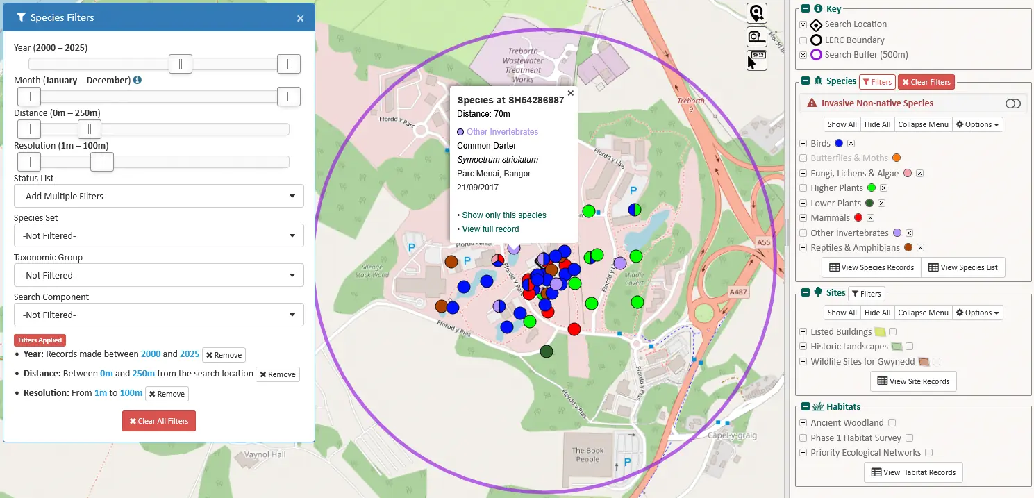
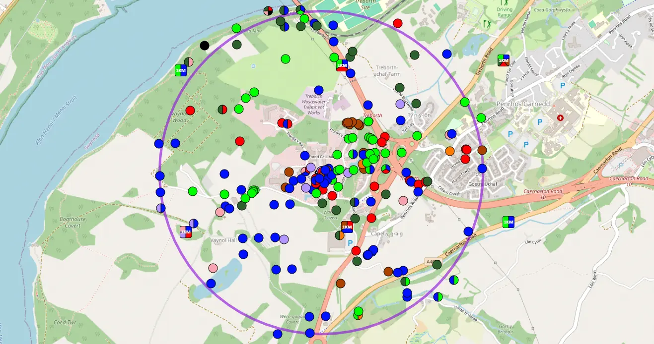
Sand dunes with Marram Grass, Morfa Harlech © Richard Gallon

eMapper

eMapper is part of a suite of tools associated with our main Orca system, and provides customers with access to their data via an interactive map. To produce an eMapper report you'll need to be an Orca user, but you may have received a link to an eMapper report, which allows you to access the data using a standard web browser.

A screenshot of an eMapper report showing species points plotted on a map © Cofnod

What is eMapper?

eMapper is Cofnod's online mapping tool, used to represent the data we hold in an easy-to-use yet powerful mapping interface. eMapper looks and acts a little like a GIS map, layering a variety of common data types used in our reporting, including points (species data) and polygons (sites and habitats), as well as links to spatially referenced documents held in our data management system, Orca.

Using eMapper

At Cofnod we use eMapper to provide customers with the data we hold. Each eMapper report has its own unique URL or web address, meaning it can be opened in a standard web browser. The user can then interact with the data, removing or adding layers, applying filters and downloading data in variety of formats. We've built in some nice, simple to use, tools which allows the user to quickly see data by distance, time or status.

A screenshot showing how to use filters in eMapper © Cofnod
Using filters in eMapper

eMapper is part of the Orca suite of tools and is only available to create eMapper reports for Orca users. If you are interested in seeing more of eMapper's features, have a look at our sample report, or contact us if you'd like us to demonstrate the system further. 

Contact us

On the Record

On the Record is our monthly online newsletter. It's full of interesting information about local wildlife recording, including that month's events and what to look out for in our Species Focus feature. Subscribe now to get next month's issue .

Loading...